| | Hafan Home | | | | Chwilio Search | | | | Hanes a dogfennau History & records | | | | Mapiau Maps |
|
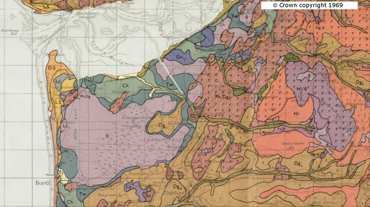
Cyhoeddwyd mapiau sy'n dangos y mathau gwahanol o bridd ar draws Lloegr a Chymru gan y 'Soil Survey of Great Britain'. Daw'r map yma o'r cyfrol Gogledd Ceredigion, cyhoeddwyd yn 1970. Mae gennym rhanfap o ardal Llangynfelyn ar 150dpi, ynghyd ag esboniad o'r lliwiau a chôdiau. © Hawlfraint y coron yw'r mapiau, 1969 |
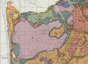 |
The Soil Survey of Great Britain produced highly detailed maps of the soil types across England and Wales. This map is taken from the North Cardiganshire volume, published in 1970. We have an extract of the map covering the parish at 150dpi, together with the Explanation of the various colours and codes. The maps are ©Crown copyright, 1969 |
| Cwestiynau? Sylwadau? Beth ydych chi'n meddwl am y tudalen hwn a gweddill y wefan? Dywedwch yn y llyfr ymwelwyr. Questions? Comments? What do you think about this page and the rest of the site? Tell us in the guest book. |