| | Hafan Home | | | | Chwilio Search | | | | Hanes a dogfennau History & records | | | | Mapiau Maps |
|
Arolwg Ordnans 1" 1919/1947 |
Ordnance Survey 1" 1919/1947 |
|
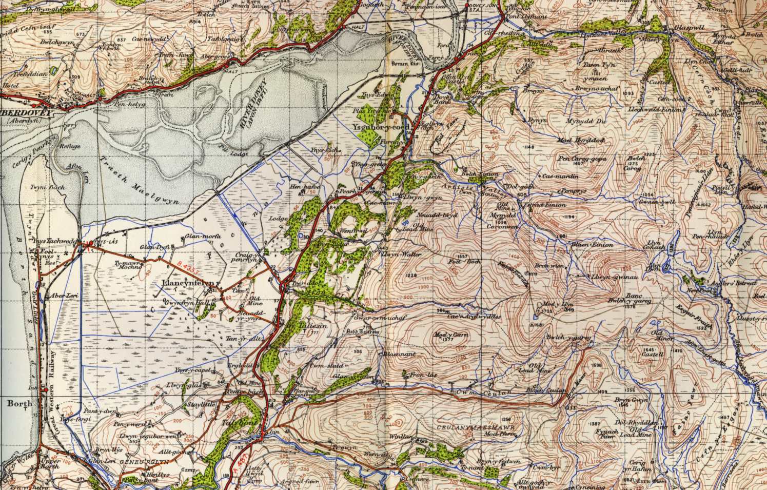
Cyhoeddwyd map cyfres gyntaf yr Arolwg Ordnans un fodfedd o Ogledd Sir Aberteifi yn 1837. Mae'r wlad wedi cael ei ail-fesur, a'r mapiau eu diweddaru yn rheolaidd erbyn hynny. Dyma dyfyniad o dalen 127 (Aberystwyth), cyhoeddwyd yn 1947 ond seiliedig ar waith dirfesuro 1919 (gyda cywiriadau). Mae gennym dyfyniadau mwy, o'r plwyf oll, ar 150 dpi. Gweler hefyd y fersiwn seiliedig ar waith aildirfesuro llawn yn 1948 (y seithfed cyfres). Mae'r fersiwn yma o'r map OS (i'r wlad cyfan) ar gael ar-lein ar VisionOfBritain.org.uk. |
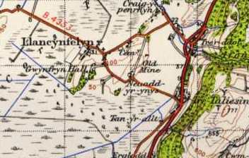 |
The first edition of the O.S. 1" to the mile map for North Cardiganshire was published in 1837. The country has been regularly re-surveyed and the maps updated ever since. This is an extract from sheet 127 (Aberystwyth), published in 1947 but based on surveys done in 1919 (with corrections). We also have larger extracts, covering the whole parish, at 150 dpi. See also the version based on a full re-survey in 1948 (seventh series). This version of the OS map (for the whole country) is available on-line at VisionOfBritain.org.uk. |
| Cwestiynau? Sylwadau? Beth ydych chi'n meddwl am y tudalen hwn a gweddill y wefan? Dywedwch yn y llyfr ymwelwyr. Questions? Comments? What do you think about this page and the rest of the site? Tell us in the guest book. |