| | Hafan Home | | | | Chwilio Search | | | | Hanes a dogfennau History & records | | | | Mapiau Maps |
|
Arolwg Ordnans 1", Dywigiad Rhyfel 1940 |
Ordnance Survey 1", War Revision 1940 |
|
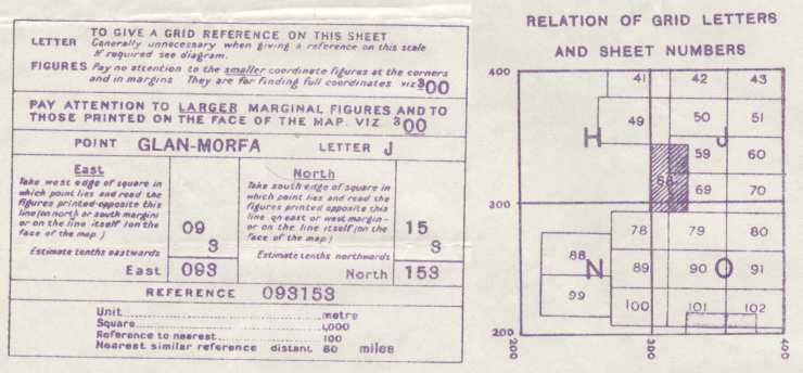
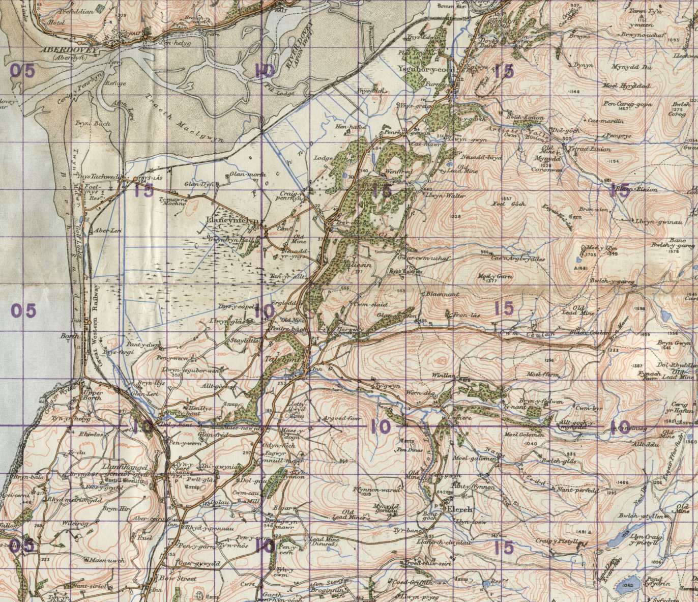
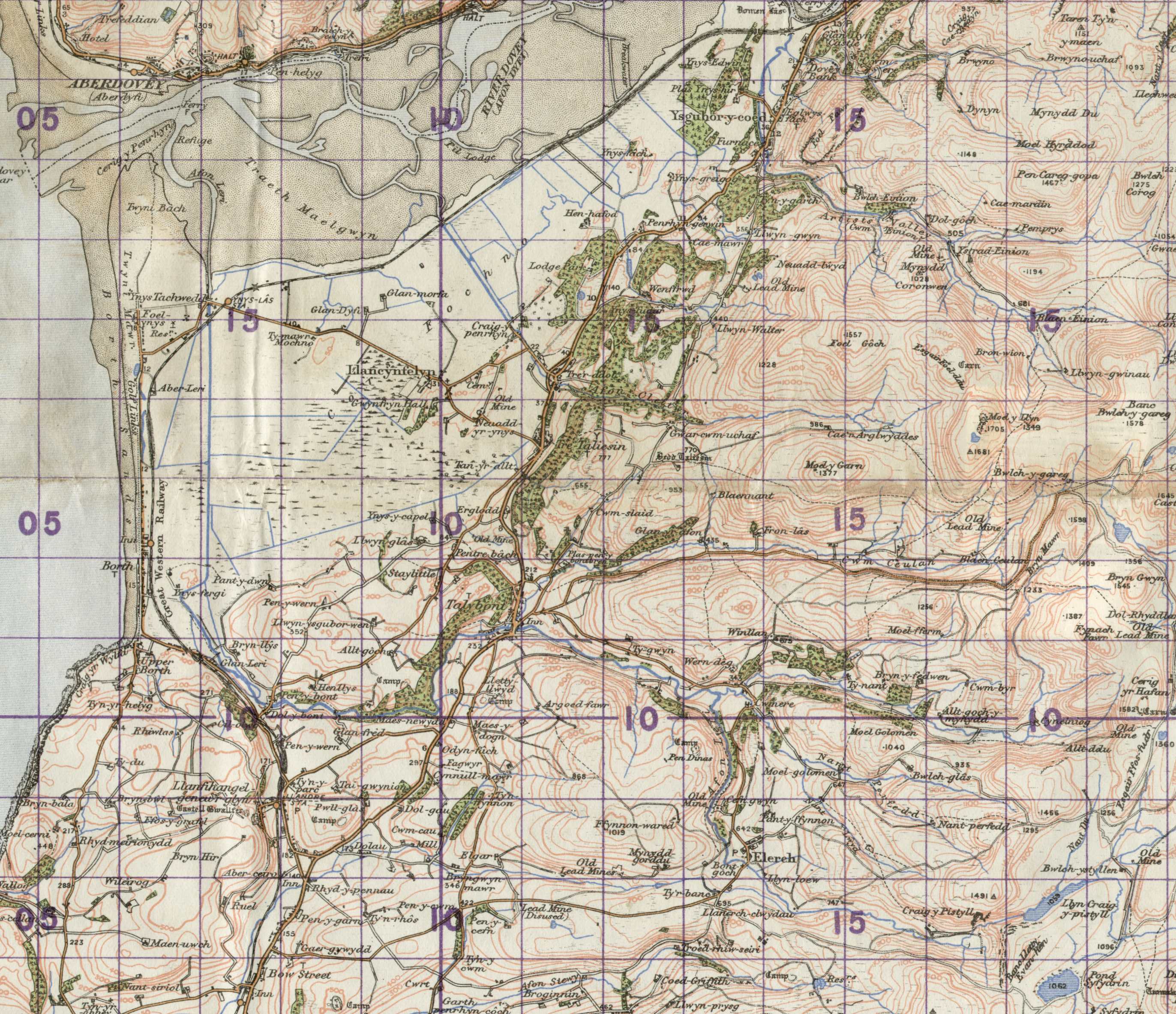
Dyma amrywiad diddorol, map 1 modfedd wedi'i marcio 'War Revision 1940'. Seiliedig ar y 5ed cyfres, gan ddefnyddio data o 1922 gydag adolygiadau. Tros-argraffwyd y cyfeiriadau grid mewn inc porffor ac mae'n defnyddio system grid gwahanol ( a chyfrinachol) i'r system arferol. Mae Capel Rehoboth yn Nhaliesin yn J112135 (neu 31123135) yn lle SN657914 (y cyfeiriad cyfoes). Mae'r tros-argraffu porffor yn mynegi mai rhan o gyfres GSGS 3907, (Geographical Section, General Staff) yw e, cyhoeddwyd gan y War Office, 1932. Dyma ranfap o ddalen 68 (Y Bermo ac Aberystwyth) o'r @Popular Edition'. Graddfa yw 150 dpi. Mae gennym hefyd rhanfapiau fwy, o'r plwyf a'r ardal o'i amgylch, ar 150 dpi (303KB) a 300 dpi (993KB). |
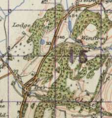 |
This interesting variation of the standard 1 inch maps is marked 'War Revision 1940'. The map is based on the 5th series, using 1922 data, with revisions. The grid references were over-printed in purple and use a different (and officially secret) system instead of the standard OS grid. Here Rehoboth chapel in Taliesin is at J112135 (or 31123135) instead of SN657914 (the modern reference). The purple overprinting states that the map is part of the GSGS 3907 series (Geographical Section, General Staff), published at the War Office 1932. This is an extract from sheet 68 (Barmouth and Aberystwyth) of the 'Popular Edition'. This is at 150 dpi. We also have larger extracts, covering the whole parish and surrounding area, at 150 dpi (303KB) and 300 dpi (993KB). |
| Cwestiynau? Sylwadau? Beth ydych chi'n meddwl am y tudalen hwn a gweddill y wefan? Dywedwch yn y llyfr ymwelwyr. Questions? Comments? What do you think about this page and the rest of the site? Tell us in the guest book. |